WEBINAR
Field Protocol for Fish Passage Structure Monitoring: A Training Workshop
Welcome to the aopMAP program!
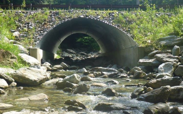
Providing effective Aquatic Organism Passage (AOP) at water crossings represents a significant investment and management priority for various agencies across the country. As billions of additional dollars are made available to replace our aging infrastructure, monitoring the effectiveness of water crossings over time becomes increasingly more important in ensuring passage goals are achieved and maintained. With design approaches varying across the world, a consistent protocol for collecting performance data becomes essential in helping environmental agencies, infrastructure owners, and tribal entities in understanding failures and successes. Recognizing the lack of consistent performance data and a standardized monitoring protocol, the Western Federal Lands Highway Division, supported by WSP and Natural Waters, has developed a standardized protocol and a accompanying mobile application for use by DOTs, transport agencies and owners, design consultants, and other infrastructure management professionals, nationwide. The process is not focused on a particular design philosophy, fish species, or region of the country. The monitoring and assessment protocols are intended to be applicable to all design styles, all aquatic species of concern in all regions of the country. The monitoring protocol supports and standardizes data collection efforts, with the long-term target of evaluating the effectiveness of varied AOP designs and documenting best practices in varied locations for the benefit of future design efforts.
This workshop will provide participants an overview of various AOP structures and detailed instruction on the WFL monitoring protocol and accompanying mobile application. This workshop will teach participants in standardize methods for collection of field data, definitions for key geomorphic terms, and practical usage of the WFL mobile application. The target audience is junior to mid-level professional staff with general exposure to stream environments and water crossing installations. Audience is expected to have varied backgrounds including but not limited to maintenance staff, civil engineers, fisheries biologists, fluvial geomorphologists, interns, and environmental scientists. The workshop learning level will be set assuming that the audience understands general roadway / stream infrastructure but has none to very limited experience of AOP, fisheries, or fluvial geomorphology.
Participants are encouraged to have an ESRI® ArcGIS Online account, download the ESRI Survey 1-2-3 mobile application, and the publicly available “WFL AOP Assessment Stage 2 V2.1 DEMO” survey (available with Survey 1-2-3). Use of the mobile application will enhance the training experience by is not a requirement. Contact your IT department to inquire about ESRI ArcGIS Online access and the Survey 1-2-3 application. Access to ESRI systems is not provided by WFLHD or it’s project partners.
We feel your involvement in this workshop will be beneficial to your agency and assist in growing the monitoring database to better understand the effectiveness of AOP designs. We look forward to your participation.
CONNECT WITH US
© 2022 WSP